Apr17
By erjavecj
Category: GIS Maps Leave a Comment
GIS Works with Imagery of All Kinds
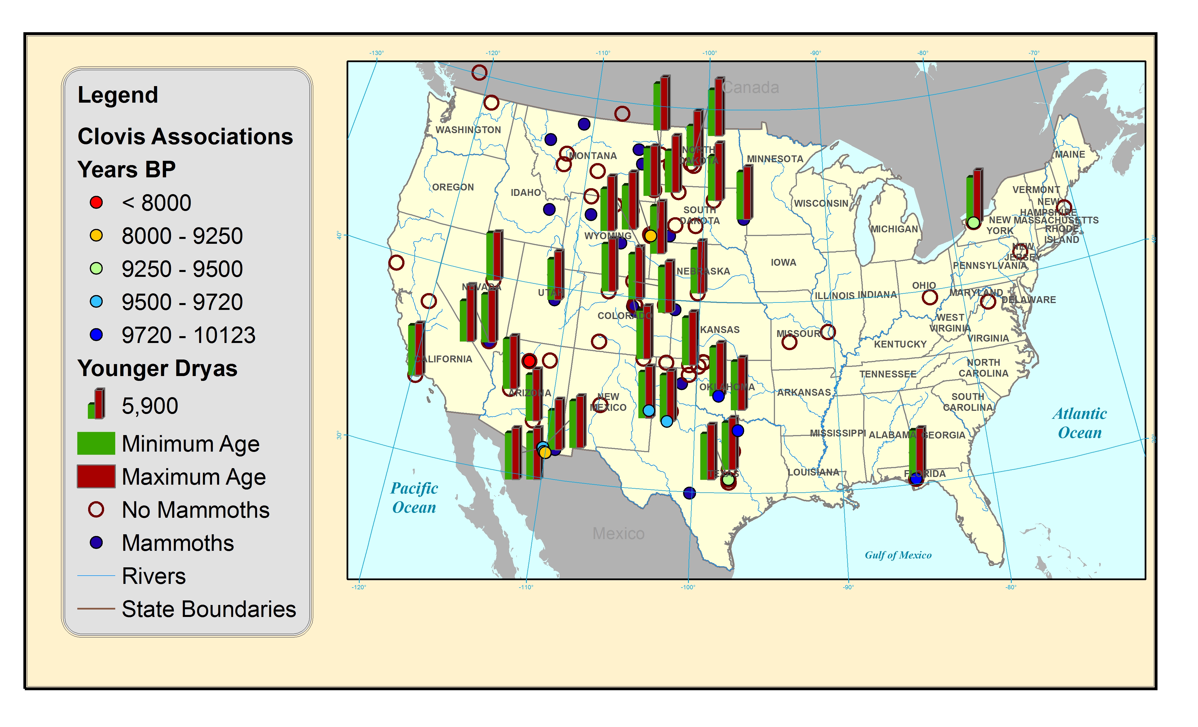
Distribution of Younger Dryas “Black Mat Soils” and Mammoth Finds
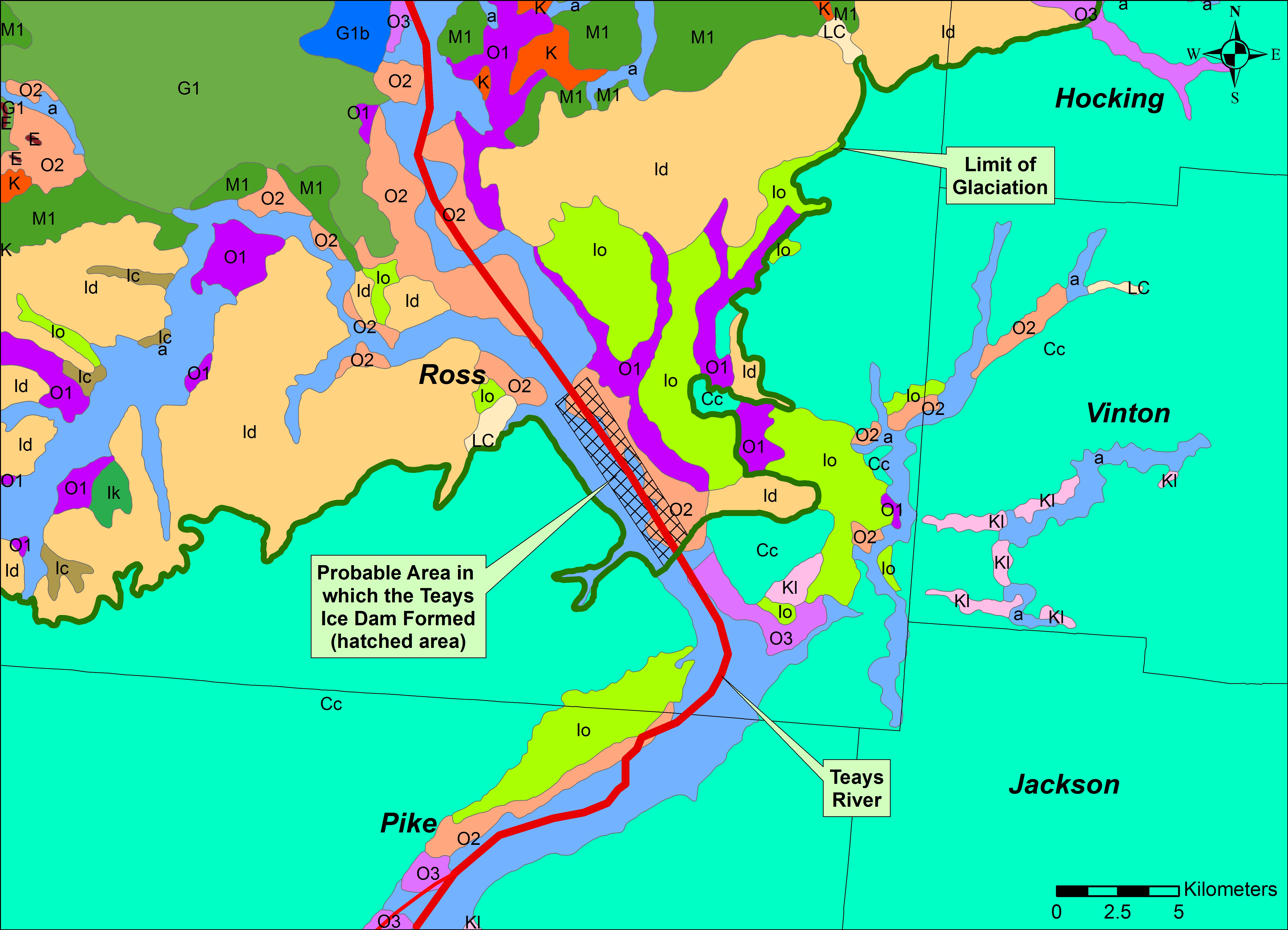
Flood Plain Zones in Chillicothe, Ohio
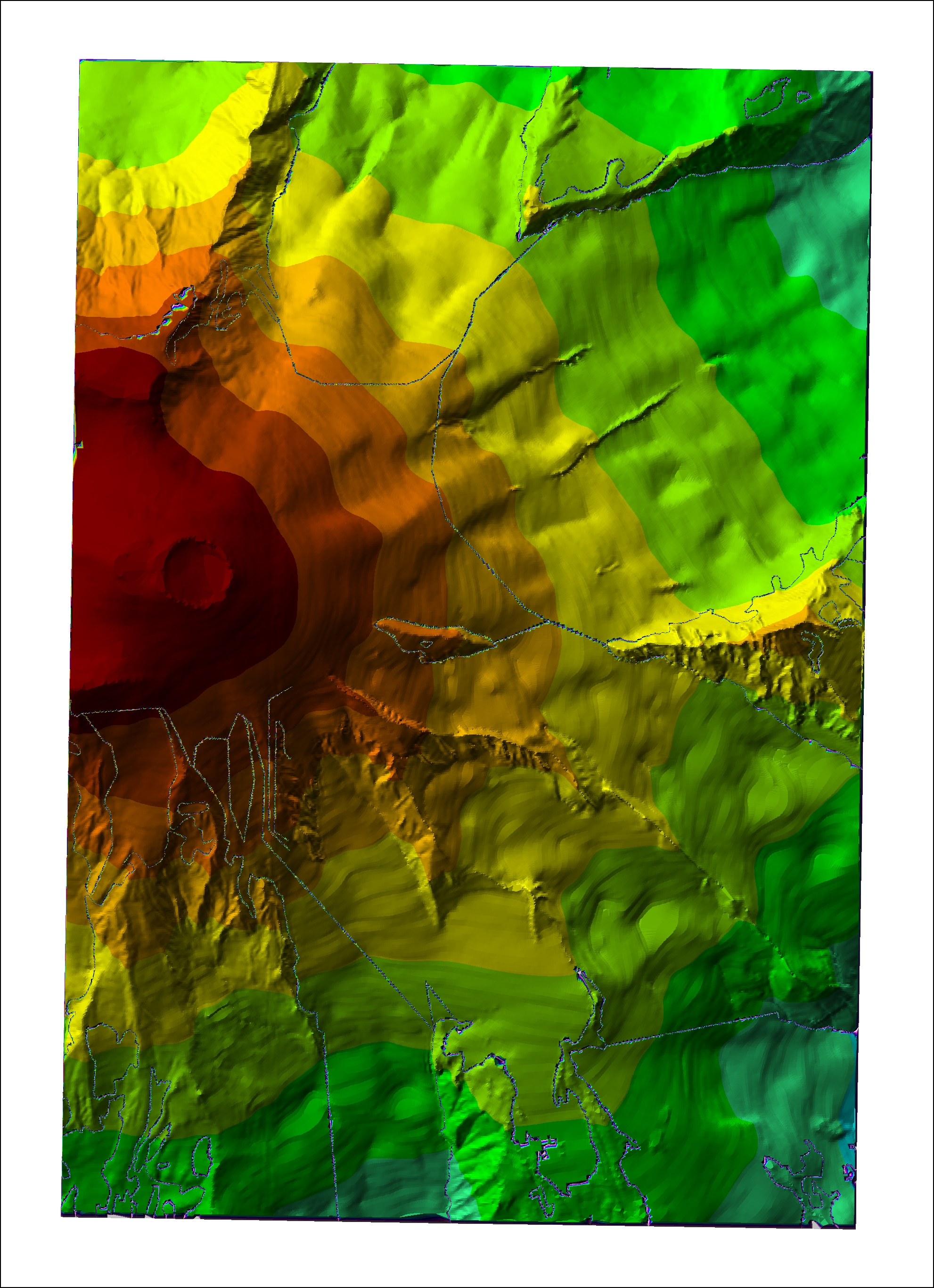
3D Modeling Using a Digital Elevation Model
Apr9
Category: GIS Animations Leave a Comment
Apr4
Category: Uncategorized Leave a Comment
Website is a work in progress! Please check back!
©2026 All Rights Reserved.
Blog at WordPress.com. | The Designfolio Theme by Press Coders

 GIS Works with Imagery of All Kinds